
As industrial navigation systems become increasingly important in autonomous vehicles, underwater equipment, stabilized platforms, and other advanced applications, a single navigation sensor may not always be sufficient to meet the requirements for accuracy, continuity, and environmental adaptability.
Different navigation components are designed to solve different technical problems. A high-performance IMU can provide accurate inertial measurements, while an integrated navigation board can combine inertial data with GNSS positioning to deliver more complete navigation information.
Honeywell's HG4930 tactical-grade IMU and the locally developed o360 integrated navigation board represent two different approaches to navigation hardware. The HG4930 focuses on high-precision inertial measurement, while the o360 combines IMU and GNSS technologies through integrated navigation algorithms.
Although their product forms and technical positioning are different, their capabilities can complement each other in demanding navigation applications. For engineering projects requiring reliable precision navigation hardware, combining these technologies provides a flexible approach to system design.
Different Technologies with Complementary Strengths
The potential value of combining the HG4930 and o360 comes from the different functions they provide.
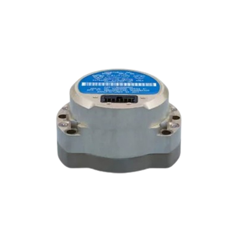
The HG4930 is an independent inertial measurement unit designed for high-precision measurement of motion and attitude. With a gyroscope bias stability of 0.25°/hr and an accelerometer bias stability of 0.025 mg, it can provide accurate inertial data for systems requiring reliable motion sensing.
An IMU is an important component in navigation systems because it can continue providing motion information even when external positioning signals are temporarily unavailable. However, inertial navigation errors naturally accumulate over time.
The o360, on the other hand, combines an inertial measurement module with GNSS positioning technology. Through sensor fusion, the system can use satellite positioning information to correct inertial errors and provide more continuous navigation performance.
This creates a natural technical complement:
-
The HG4930 provides high-quality inertial measurement data.
-
The o360 provides integrated IMU and GNSS navigation capabilities.
-
Sensor fusion helps improve positioning continuity and navigation stability.
-
The combined hardware approach can be adapted to different system architectures.
For applications where navigation accuracy and continuity are both important, this type of complementary configuration can offer greater flexibility than relying on a single sensor technology.
Improving Navigation Performance in Challenging Environments
Many industrial navigation applications operate in environments where GNSS signals may be unstable, blocked, or unavailable.
Examples include tunnels, urban canyons, indoor industrial areas, underwater environments, and other complex operating conditions. In these situations, a navigation system needs to maintain reliable performance even when satellite positioning cannot be continuously used.
High-quality inertial measurement becomes particularly important in such scenarios. The HG4930 can provide continuous motion and attitude data, while an integrated navigation platform such as the o360 can combine available GNSS information with inertial data when satellite signals are accessible.
This combination can help support a more adaptable navigation architecture in which different sensors contribute according to the actual operating environment.
Applications in Autonomous Driving
Autonomous vehicles require accurate positioning, stable attitude information, and continuous navigation. However, satellite signals may be weakened or blocked in environments such as tunnels, underground passages, and dense urban areas.
In an integrated navigation architecture, the HG4930 can provide high-precision inertial measurements, including attitude and acceleration information. The o360 can combine inertial data with GNSS positioning to support continuous navigation and positioning correction.
When GNSS signals are temporarily unavailable, inertial data can help maintain navigation continuity. When satellite signals become available again, positioning information can be used to help correct accumulated inertial errors.
This complementary approach can be valuable for autonomous driving systems that require stable navigation performance across changing environments.
Supporting Underwater Navigation Applications
Underwater vehicles present a different navigation challenge. Since GNSS signals cannot normally be received underwater, traditional satellite-based positioning is unavailable during submerged operations.
As a result, underwater navigation depends heavily on inertial measurement and other complementary navigation technologies.
The HG4930 can provide high-precision inertial data for tracking vehicle motion and attitude. Combined with an integrated navigation architecture and suitable sensor fusion algorithms, this type of hardware configuration can support continuous navigation in GNSS-denied environments.
Potential applications include:
-
Underwater surveying
-
Subsea inspection
-
Marine exploration
-
Autonomous underwater vehicles
-
Underwater infrastructure operations
For these applications, inertial sensor accuracy is particularly important because navigation errors can accumulate over time when external positioning references are limited.
Improving Stabilized Platform Performance
Industrial stabilized platforms also require accurate motion sensing and positioning information.
Platforms used for optical equipment, surveying systems, industrial sensors, and other precision equipment may need to compensate for vibration and attitude disturbances while maintaining accurate positioning.
In this type of application, the HG4930 can provide rapid and accurate inertial data for detecting attitude changes and motion disturbances. The o360 can provide integrated positioning information through its IMU and GNSS capabilities.
Together, these functions can support:
-
Attitude compensation
-
Position calibration
-
Motion disturbance detection
-
Platform stabilization
-
Improved equipment operating accuracy
The specific system architecture will depend on the application requirements, but combining high-performance inertial measurement with integrated navigation capabilities provides engineers with more options when designing precision stabilization systems.
Hardware Selection Should Match the Application
Although the HG4930 and o360 can provide complementary capabilities, the appropriate system configuration should always be determined according to the actual application.
Engineers may need to consider:
-
Required navigation accuracy
-
GNSS availability
-
Operating environment
-
Size and weight limitations
-
Interface requirements
-
System integration complexity
-
Environmental conditions
-
Required navigation continuity
For some applications, an integrated navigation board may provide sufficient performance as a complete solution. For applications with more demanding inertial measurement requirements, a higher-performance IMU may provide additional value.
The main advantage of a combined hardware approach is flexibility. Engineers can select the most suitable configuration according to the performance requirements of the final navigation system.
The Importance of Reliable Hardware Supply
For industrial navigation projects, hardware availability can directly affect development and deployment schedules. Delays in obtaining key navigation components may slow down system integration, testing, and final delivery.
Working with an experienced and authorized distributor can help simplify the procurement process, particularly when a project requires multiple navigation products from different technology platforms.
Shanghai Binyin Electronics provides hardware supply services for Honeywell's HG4930 and the o360 integrated navigation board. By supporting the procurement of both products, the company helps customers access navigation hardware for applications ranging from high-precision inertial measurement to integrated IMU and GNSS navigation.
For engineering teams developing precision navigation systems, a coordinated supply channel can also help simplify procurement and improve project efficiency.
Building More Flexible Precision Navigation Systems
The combination of the HG4930 and o360 demonstrates how different navigation technologies can be used together to address complex industrial requirements.
The HG4930 provides high-precision inertial measurement, while the o360 integrates inertial sensing with GNSS-based navigation. Their different technical strengths allow engineers to consider a more flexible approach when designing navigation hardware systems.
From autonomous vehicles and underwater equipment to industrial stabilized platforms, the demand for accurate and continuous navigation is continuing to grow. As operating environments become more complex, combining complementary sensor technologies can provide a practical way to improve system adaptability and reliability.
Ultimately, the most suitable navigation solution depends on the specific application, system architecture, and performance requirements. With appropriate hardware selection and professional integration, high-performance IMUs and integrated navigation platforms can work together to support the next generation of industrial navigation systems.
www.bingyinelec.com
Bingyin Electronics